Our 13 day Everest Base Camp Itinerary
5 Aug 2019 whd
There are a few trekking routes around the Sagarmatha National Park and Nepal in general. We trekked the Everest Base Camp route but adding in the Gokyo Lakes on your way up or down is very popular and looks incredible to. The Everest Base Camp trek can be dangerous, even fatal, if you don’t plan it or go prepared. Before we headed to Nepal we did a lot of planning, reading bogs, looking at maps and comparing itineraries until we found one that fitted us best and we felt like we knew the nearby villages/route off by heart. Saying that it is one of the most popular treks you can do, with over 300,000 people going every year and its actually quite a simple route, that anyone can do. It provides the most stunning views every day, tests you physically and mentally to the brim and then leaves you the biggest sense of accomplishment you could feel.
-We did our trek from 4th Feb to 16th Feb.
13 Day Everest Base Camp Itinerary
- Day 1: Lukla to Phakding (or Monjo if you can make it)
- Day 2: Phakding to Namche Bazaar
- Day 3: Namche Bazaar Acclimatization Day
- Day 4: Namche Bazaar to Tengboche
- Day 5: Tengboche to Dingboche
- Day 6: Dingboche Acclimatization Day
- Day 7: Dingboche Lobuche
- Day 8: Lobuche to Gorak Shep to Everest Base Camp, back to Gorak Shep
- Day 9: Gorak Shep to Kala Pattar to Pheriche
- Day 10: Pheriche to Tengboche
- Day 11: Tengboche to Namche Bazaar
- Day 12: Namche Bazaar to Lukla
- Last Day: Fly Lukla to Kathmandu
The Flight Kathmandu to Lukla (Worlds most Dangerous airport)
Flight cost $177 one way. Book these at the many tour agencies in Kathmandu or at your hostel. Some people decide to walk to Lukla instead, adding on an extra 5 days.
After being told that there had been canceled flights for the past 5 days due to bad weather Ben and I didn’t hold out much hope of making it to Lukla. The night before we were due to fly Raj, our trip organizer informed us that we would not be getting on our plane but not to worry as he had put us onto a helicopter owned by his friend and we would be on the first flight out in the morning. Both slightly terrified but also anxious to leave we sat and waited for the fog at Kathmandu airport to clear. 5 hours later we hopped onto the Helicopter with 3 others and made our way to Lukla. Although I was shitting it in this small, shaking copter and windy valleys, it still offered the best views I’ve seen from the air. Passing the Himalayas on your left and tiny hilltop villages below made this a flight to remember.
Day 1 – Lukla (2900m) to Phakding (2610m)
Total trekking time: 3-4 hours (8km)
Description: Once your flight lands grab some lunch in Lukla at a nearby Teahouse and then began hiking. Its not uncommon for flights to Lukla to be delayed or cancelled so be prepared for a wait. We arrived in Lukla at 12 instead of 8am. The trek was simple passing a few smaller villages, and following parts of the river.
Difficulty Level: 4 – Today was easy, with mild uphill and downhill portions, in good spirits to so that helps!
Teahouses are cold so we always stayed wrapped up when we arrived, until the fire is lit at around 5pm. Then we sat cuddled around it with Warm mango tea and our Dhal Bhat dinner (Nepalese staple dish, plus you get unlimited rice to! Will fill you up if you have a big appetite) Cost of room- 300 rupees or free when we bought dinner there.
Day 2 – Phakding (2610m) to Namche Bazaar (3440m)
Total trekking time: 6 – 7 hours (11km) Rest time: 45 minutes lunch at Monjo
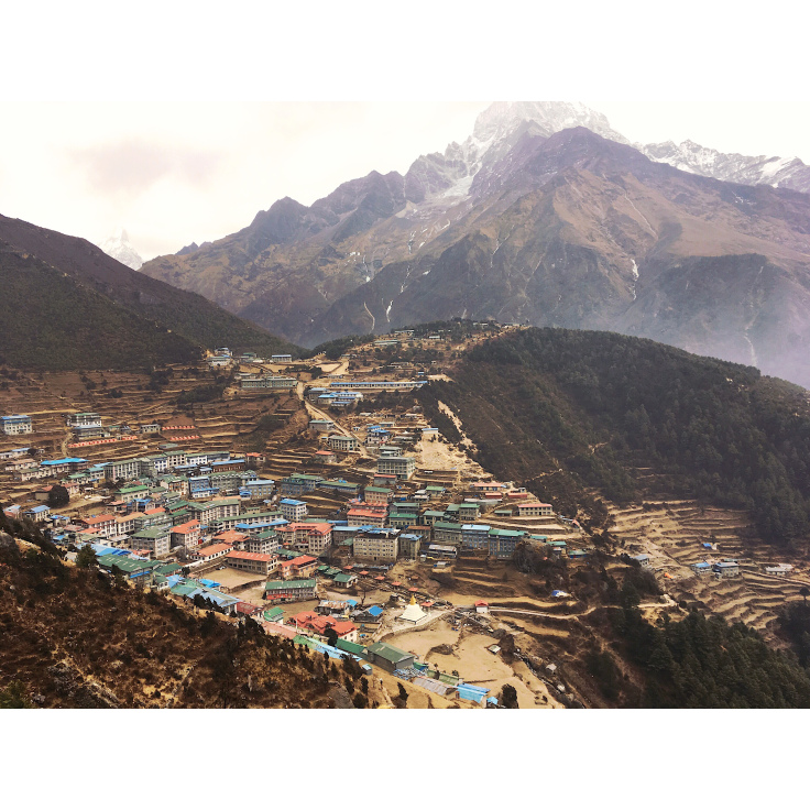
Description: Start the day crossing suspension bridges and a easy 3 hour walk to Monjo before the last suspension bridge where it is 3 hours or more of uphill hiking and walking through Namche to your Teahouse. In this 3 hour walk you climb about 600 metres up rocky steps and a steep dusty dirt track all the way to Namche- its a knackering afternoon. Only made better by a viewpoint that allows you your first glimpse at Everest! Make sure to drink lots of water, at least 3 liters- you can re fill your bottles at any tea house along the way.
Unfortunatly i woke up at 7am to be sick, couldn’t eat breakfast and then was sick again at 8am whilst everyone was packing up to leave. This threw me off completely as i didn’t expect to feel like this on day 2. The last thing you want to do when your tummy is turning is walk all day carrying a bag but I strapped it on and told Ben and Dorche were going, but slow. At that point we didn’t think that I would make it to Jorsalle, a small village half way where you can stop for lunch and grab your permit, let alone to Namche Bazaar but I somehow managed it. (Thanks to Ben and Dorche for carrying my heavier gear). Namche is the last big town so stock up here if you need anything, they have bakerys, bars where you can watch movies and an Irish pub!
Difficulty Level: 7 – Easy first few hours along the river, but the hill to Namche is a killer.
Day 3 –
My ill day. I actually got pretty bad that we nearly made the decision to go down but i didn’t want this to stop us, we decided to spend another day in Namche so i could use this time to fully rest in bed, get everything out of me and regain some strength. We became a day behind schedule but caught it up on the way down. This is the day where immodeuim became my best friend and allowed me to carry on- I unfortunately missed the toilet this evening and spent it cleaning my Down coat and toilet seat. Oh and then pooped in my leggings when i was sleeping. I cried lots today.
Day 4 – Acclimatisation day
Day Trek: Depends on hike. 2 – 3 hours. We hiked to the Sherpa Museum for a view of Everest, about 1 – 1.5 hour round trip. Then we hiked up the hill over Namche to the Sherpa Village Lodge, about 1 – 1.5 round trip. I felt a bit better today and was able to eat more plain rice with it staying down. Yay. I did a short walk to the museum and view point and the views were fantastic.
Difficulty Level: 4 – Easy slope to the Sherpa Museum. The hike up to the Everest hotel was a steep climb but not too bad.
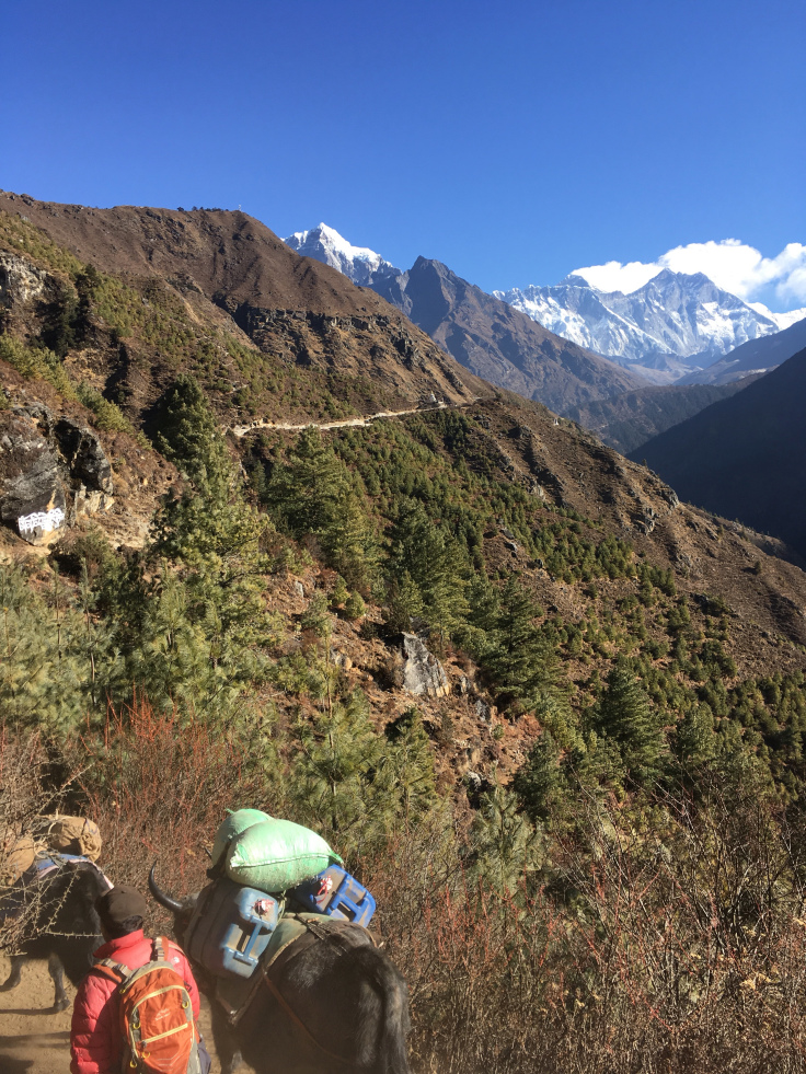
Day 5 – Namche to Tengboche (3880m)
Total trekking time: 6hours + (12km) Rest time: 45 lunch break in Phunke Tenga
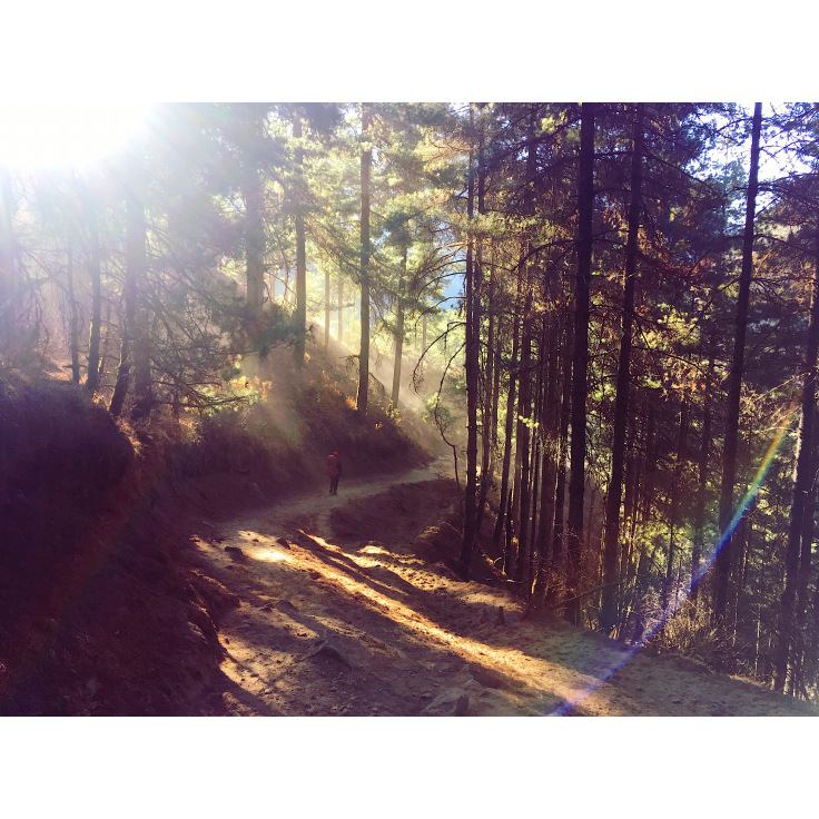
Description: It’s a steep climb out of Namche and then a level walk for about 1 hour with views of Everest and surrounding mountains with river valley below before having lunch at 3200m. The hardest part of these treks is knowing that the lower you go the more you’ll have to climb on the other side. Then head downhill (why are we going down!) for an hour before the 2 hours and 15 minutes zig-zag uphill through the pine forest before reaching Tengboche. The sun was beating down hard this afternoon and the path had little shade, making this a very sweaty, hot and difficult walk. It felt never ending and I’ve never felt happier seeing a Teahouse. We had no power this evening and here we really started to feel the cold in the evening. With single glazing and no heating Ben and I were sharing a single bed and wearing thermals in the -13 degree temperature.
Difficulty Level: 6.5 – Early easy walk on flat trail, but the down and then up were challenging.
Teahouse: Trekkers Lodge – great view of Everest from our bedroom!
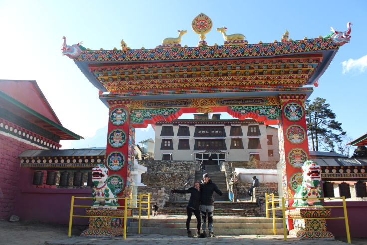
Note- visit the Tengboche monsatry when you arrive and try to catch the monks chant at 3pm.
Day 6 – Tengboche (3880m) to Dingboche (4400m)
Total trekking time: 5-6 hours with an hour stop for lunch (9km)
Description: After leaving Tengboche, there’s 30 minutes of downhill hiking within a woody forest. You’ll walk on a flat trail for what seem like hours, stepping over boulders along the way. Once you get above the tree line near Somane, the landscape make you feel like you stepped into the Lord of Rings film set or taking a stroll in Dartmoor in the UK. Definitely not what we expected up this high!
Difficulty Level: 6 – Simple hike on a well walked trail, but by now the altitude can start to take an effect on your breathing especially on the uphill before Dingboche .
Day 7 – Acclimatisation day in Dingboche
Total trekking time: 2-4 hours depending on day hike
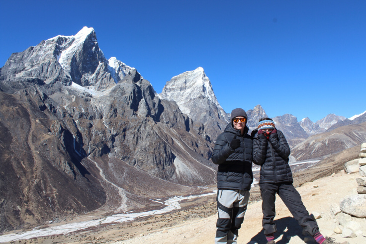
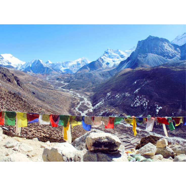
Description: A 2 hour trek in which we climbed 300m above the village. Here there was an amazing view of 4 of the highest mountains in the world. All standing over 8000m.
Mount Choyou- 8210m, Mount Makalu- 8464m, Mount Lutse- 8556m, Mount Everest- 8848m
If you wish, you can climb another hour or so to the top of the hill for even better views, but bring a wind breaker jacket. We spent the rest of the day sitting in the sun at our Teahouse and then playing cards with other trekkers until dinner. I unfortunately had the worse gas ever here and made playing cards a little more awkward than it should have been.
Difficulty Level: 6 – You get to hike without your packs, but the altitude really starts to hit you as you climb up the hill.
Note – there is no cell service in Dingboche. Wifi options available but don’t rely on it.
Day 8 – Dingboche (4400m) to Lobuche (4900m)
Total trekking time: 6 hours (10km) with a stop for lunch in Dugla.
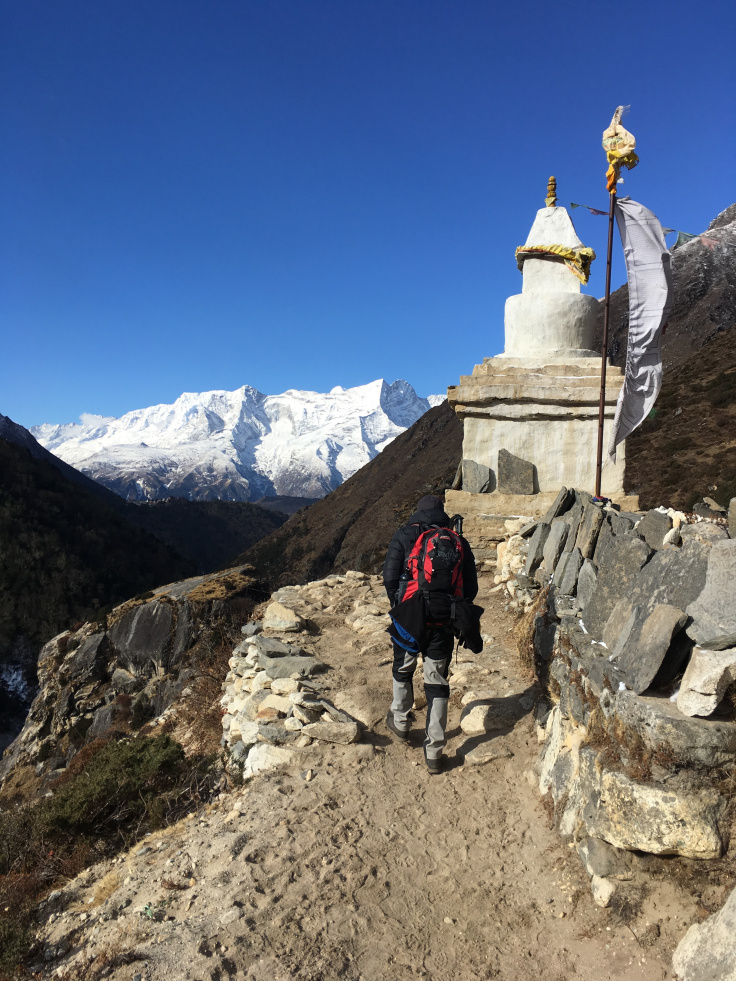
Description: After a short steep climb, or as Dorchi calls it “Sherpa gradual,”(which means its not gradual at all but infact pretty steep) out of the village this mornings walk is steady through till the rest point for lunch in Dugla. Post lunch a sharp incline of steps and rocky path lead you to a clearing littered with memorials and plaques recognising those who have lost their lives on Everest. Sherpas and Trekkers alike. The first memorial, situated to the right of the entrance, belongs to Babu Cheri Sherpa. He holds 3 world records 2 of which are still standing today:
1. Summit Everest twice in two weeks
2. 21 hours at the summit of Everest, without the use of auxiliary oxygen
3. Fastest Everest ascent- 16 hours 56 minutes
Here the temperature rapidly dropped. Sleeping in -20 degrees Celsius made for a long night of restless sleeping. We would often wake up to the sound of people coughing, vomiting or snoring (walls are paper thin). The water in the toilets had frozen solid and the altitude made getting into your sleeping bag or going to the toilet a strenuous task. I would get back to the room and be breathing as if i’d just got back from a run.
Difficulty Level: 8 – Hardest day so far. The uphill climb in the afternoon is a bitch and lack of oxygen is super noticeable now. We stopped a lot on the way up.
Teahouse: Oxygen Altitude- most trekkers stayed here so had a good atmosphere, warm fire and a TV in the common room! Room is at its coldest at about -15 tonight, wrap up warm!
Myself and Ben put the matresses on the floor so we could share more body heat. Cramped on the floor with 2 big sleeping bags made for a not so cosy but warmer nights.
Day 9 – Lobuche (4900m) to Gorak Shep (5180m) to Base Camp (5364m)
Total trekking time: 8-9 hours with 2 stops at Gorak Shep, 18k round trip
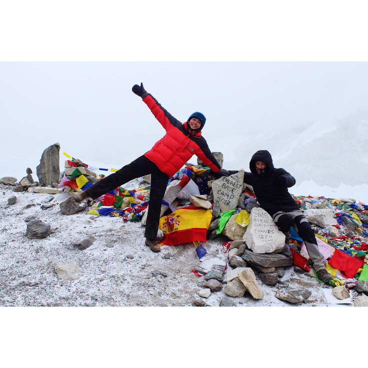
This is the day we get to reach our destination of Base Camp! The usual Base Camp trek involves carrying your gear to Gorak Shep, leaving it behind and then continuing on before returning and sleeping there that night in order to rise early and walk to Kala Patar, otherwise known as “Black Rock.” The best view point of Everest actually 200m higher than Base Camp.
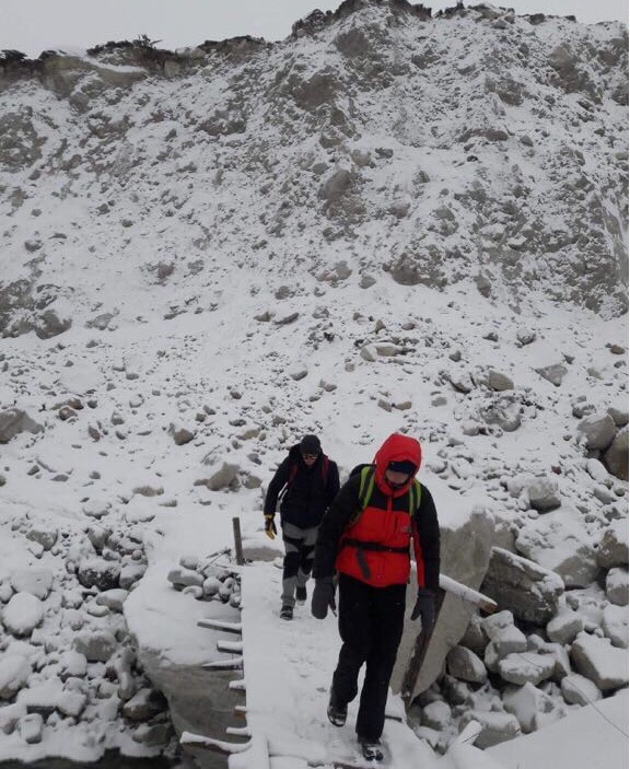
Up until this point the weather had been great with Blue skies and not too much wind. However, when we awoke at 6:30 am there was a think fog and plenty of snow. Due to the fact that Ben and I could only see about 20ft in front of us we opted to walk to Base Camp and back to Lobuche in a day. Despite the poor conditions we set off at 7am for a 2 hour walk to Gorak Shep. The walk is not too strenuous (leaving our bags at Lobuche helped with this) until you reach a sharp slope that felt like it went on forever.
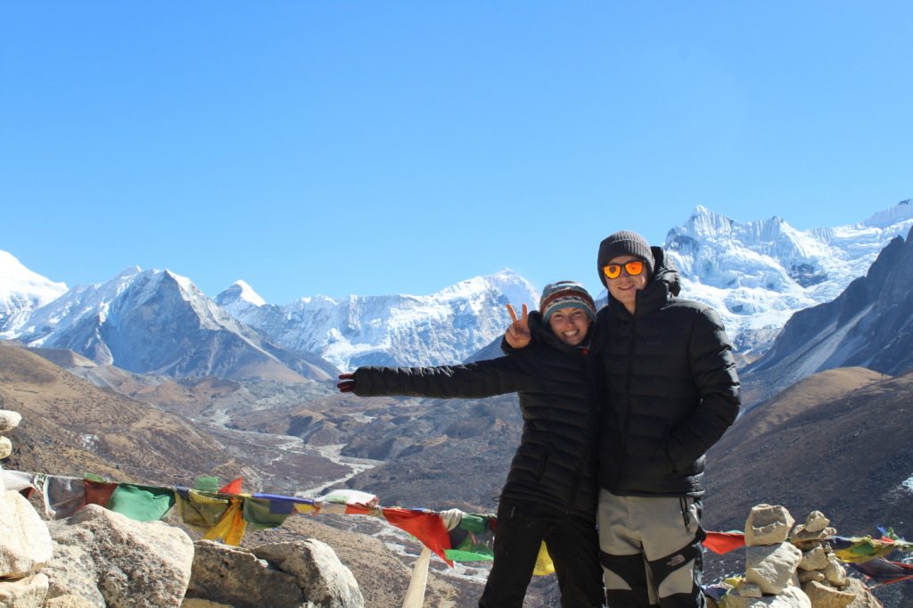
After a quick stop at Gorak Shep for a late breakfast we headed on to EBC. Ben started to get a severe headache that came on super quickly after leaving so we knew that staying back in Lobuche had been the right thing to do. The path turned to giant boulders and rock slides that you had to climb and scramble over. Not something I expected as it is a relatively trodden path up till this point. The snow and lack of visibility made this a lot harder than it usually would be, the rocks were slippery and it made the walk a lot longer. In peak season i have heard it gets very busy at this point and its almost like a que to BC. Finally at 12:10 in the snow and at -26 degrees Ben and I reached Base Camp! We hugged, shed a tear, took as many photos we could without our hands falling off and opened the packet Oreos we had been saving the entire trip for this moment.
Once we left and headed back to scrabbling over rocks, Bens headache had gotten a lot worse, making it unbearable for him. He would stop suddenly and clutch his head in his hands, I hated seeing this as there’s nothing you can do but get down quick and hope it eases off. This walk back was by far the most exhausting and stressful because but after the 9 hour round trip we made it back to Lobuche at about 4pm. Bens headache subsided, we ate our plain rice (I’m still eating plain food for my tummy, everyone else was tucking into Spaghetti, Dal Bhat or Momo’s however) and then cheersed with our water for making it to BC, surprisingly not arguing once and to getting down and eating some chicken!
Note- Many people don’t sleep well at Gorak shep and the trekkers we spoke to said it was their worst night of the trek. Sleeping at high altitude is harder anyway and a lot of people will only have about 4-5 hours sleep. I slept pretty good the whole way up, which Diamox may have helped with.
Day 10 – Lobuche (4900m) to Pangboche (3900m)
Total trekking time – 7 hours with a lunch stop in Pheriche, the food took 1 hour here and only rice was on the menu because of the snow- meaning no one could get to the potatoes under ground.
Description: A very snowy and cold walk down lay ahead of us. You can descend in altitude a lot quicker than you can go up. The treks down were 2-3 times longer than we had been doing on the ascent. We followed the river down the valley for hours and hours and passed the villages that had a few days previously been bathed in sun were now covered in snow. In peak season this would be a lovely walk back where you can take your time and enjoy feeling better and better with every step, we were just to cold to notice.
Difficulty level: 6 fairly easy walk (minus the snow and cold making my toes numb the whole way)
Note- Most people after staying at Gorak Shep will head to Kalar Patar in the morning for sunrise which offers amazing views of Everest and the surrounding mountains and then stay in Lobuche or Pheriche tonight. Our route changed because of the weather so we caught our lost day up here.
Day 11 – Pangboche (3900m) to Namche Bazaar (3440m)
Total trekking Time: 7 hours
Description: Steep up hill climb to Tengboche in the morning but after that its a relatively nice (but long) walk to Namche along the mountain side, with great views of the river below. The sun was shining today and it was a nice change to walk in 2 layers not 6, we were feeling good and my stomach was getting better everyday meaning i could finally have some tastier food off the menu. It was Valentines day today for myself and Ben so we stopped at a Pagoda and attached a lock with our names and dates to a nearby railing, that looked onto Everest. Dorche still sends us photos of it when ever he passes.
Difficulty level: 6, hard up hill climb in the morning to Tengboche and then a steady up and down path to Namche. Sun is back now to so its a pleasant walk.
Day 12 – Namche Bazaar (3440m) to Lukla (2900m)
Total trekking time: Long day! 8-9 hours with an hour lunch stop in Phakding.
Description: Steep decline down the Namche Hill before following the river passed villages and finally reaching lunch in Phakding where we stayed the first night. The walk to Lukla is pretty simple but we had a lot of up and down sections. By this point we were just tired and the day felt so long that it felt harder than it should! We also hit a huge fire, that had swept up the valley high up into the mountain. We saw the smoke from a while back and asked people we passed if it was safe to carry on. We reached the village it had started in, where a Teahouse had caught alight after some oil had spilt from cooking. It luckily didn’t spread to the neighbouring houses or shops but went up wiping out all the trees along the mountain side. It was a shocking site to see, knowing that out here they have no fire extinguishers or real help when these things happen.
Difficulty level: 6-7
Day 12 – Fly Luckla to Kathmandu
Our last morning! We caught the second flight out at 7am, in blue skies. Its a feeling you cant get used to when the plane your in, is taking off going down hill. Sit on the right hand side of the plane this time to get the amazing views while you pass the Himalayas
It was 100% the hardest thing we have ever done both physically and mentally, over 80 miles, 200,000 steps, 3000 metres climbed and too many hills/tears to count in 13 days. It pushed us both, with me being ill and Ben carrying more than he needed to and then lugging a heavy bag on our backs everyday made me question what the hell we were doing. The oxygen in the last few days were down 40% less than what you have back at home and that made walking in the day or any movement in the evening feel 10x harder and strenuous. That, going to bed in -23 and not showering or changing my 7 layers for 6 days sure does mean I can say we’ve seen each other at the worst. Saying all that its been the best damn experience we have been able to share together, trekking in the Himalayas, walking with views that take your breathe away and still being able to laugh along the way made this an experience that will stay with us forever. Cheers to my boys, cheers to my shithole bag and cheers to my plain rice diet that made me loose a stone.