


The Annapurna Circuit Trek is one of the most famous and diverse trekking routes in the world. It offers trekkers an incredible range of landscapes, from subtropical forests to alpine meadows and high-altitude deserts, all while circling the Annapurna Massif and crossing the Thorong La Pass, one of the highest trekking passes in the world.
Trek Highlights:
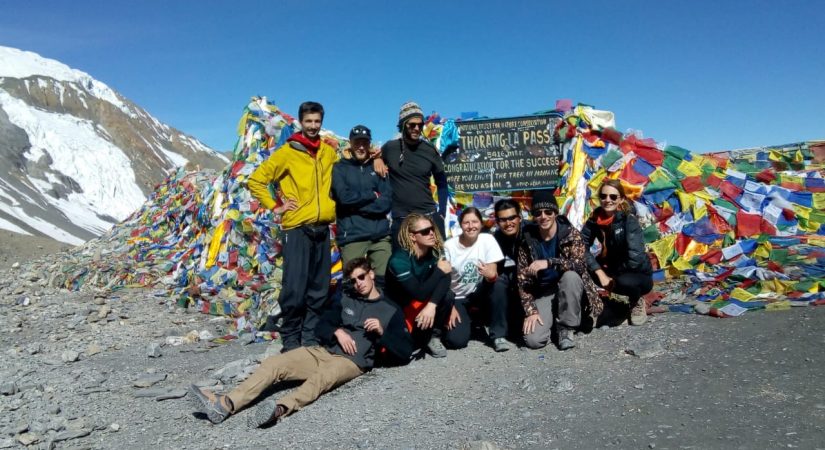
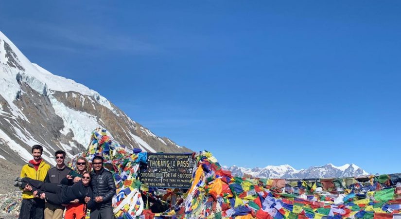
- Thorong La Pass: The trek’s highlight, the Thorong La Pass, is a thrilling experience for trekkers, offering spectacular views of the Annapurna and Dhaulagiri ranges. The pass marks the highest point on the trek at 5,416 meters (17,769 feet).
- Diverse Ecosystems: The trek takes you through a variety of ecosystems, including subtropical jungles, rhododendron forests, terraced fields, alpine meadows, and barren high-altitude desert landscapes.
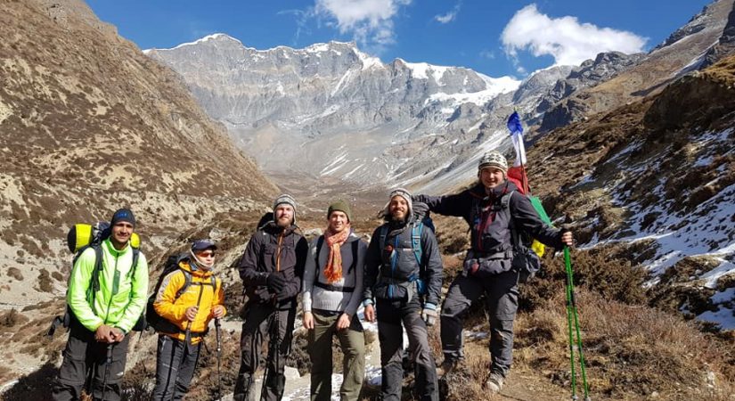
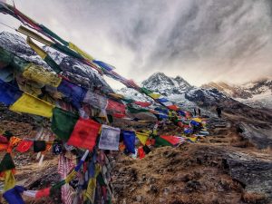
- Cultural Experience: The circuit passes through several ethnic villages, such as those inhabited by the Gurung, Magar, and Thakali people. You’ll get a chance to experience their traditional lifestyles, architecture, and hospitality.
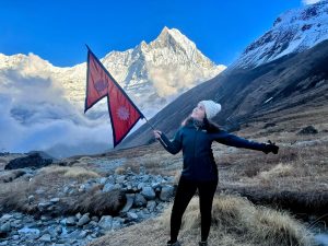
- Spectacular Views of Annapurna and Dhaulagiri: The trek provides close-up views of some of the highest peaks in the Himalayas, including Annapurna I (8,091 meters), Annapurna South, Machapuchare (Fishtail), and Dhaulagiri (8,167 meters).
- Natural Hot Springs: After a long day’s trek, trekkers can relax in the natural hot springs at Tatopani, known for their therapeutic properties.
Tips for Annapurna Circuit Trek:
- Physical Fitness: Although moderate, the trek is physically demanding, especially with the crossing of Thorong La Pass. It’s recommended to prepare physically in advance.
- Altitude Acclimatization: Take acclimatization days, especially in Manang and before crossing the pass.
- Weather: Be prepared for rapidly changing weather, particularly at higher altitudes. Carry appropriate clothing for both warm and cold conditions.
- Permits: You will need a TIMS (Trekkers' Information Management System) card and an Annapurna Conservation Area Permit (ACAP) to trek the Annapurna Circui
Trip Outline
Day 01: Drive to Besisahar by bus (6 hours) & trek to Bulbule (Alt.840m/2,755ft), 2 hours walk.
Day 02: Trek to Ghermu (Alt.1170m/3,837ft), 5 hours walk.
Day 03: Trek to Tal (Alt.1700m/5,576ft), 5-6 hours walk.
Day 04: Trek to Danakyu (Alt.2300m/7,544ft), 4-5 hours walk.
Day 05: Trek to Chame (Alt.2670m/8,758ft), 4-5 hours walk.
Day 06: Trek to Pisang (Alt.3200m/10,496ft), 5 hours walk.
Day 07: Trek to Manang (Alt.3540m/11,611ft), 5 hours walk.
Day 08: Acclimatization Day.
Day 09: Trek to Yak kharka (Alt.4018m/13,179ft),Thorung Phedi (Alt.4500m/14,760ft), 7 hours walk.
Day 10: Trek over Thorang-la-pass (Alt.5416m), Trek to Muktinath (Alt.3760m/12,332ft), 8 hours walk.
Day 11: Trek to Jomsom (Alt.2720m/8,921ft), 5 hours walk.
Day 12: Drive to Tatopani (hot springs), (Alt.1190m/3,903ft), 5 hours.
Day 13: Drive to Pokhara (Alt.820m/2,689ft), 7 hours.
Detail itinerary
Day 01: Drive to Besisahar by bus (6 hours) & trek to Bulbule (Alt.840m/2,755ft)
6 Hrs L/D Tea House
To Besisahar (830m) – 7 hours: Our journey begins. After breakfast, set off on the 185 kilometer, 7 hour, drive to Besisahar. Relax en route and enjoy lush scenery as we drive beside the beautiful Trishuli River. On arrival at Besisahar we can already glimpse a taste of things to come – stunning snow-capped mountains.
Day 02: Trek to Ghermu (Alt.1170m/3,837ft)
5 Hrs B/L/D Tea House
Trek to Bahundanda/ Ghermu (1,310m): Today sees introductions to waterfalls, suspension bridges plus more paddy fields and beautiful scenery
Day 03: Trek to Chame / Tal (Alt.1700m/5,576ft),
6 Hrs B/L/D Tea House
To Chamche (1,430m) – 5 hours: After Bahundanda, the trail initially drops for a short distance, then continues through local villages. Crossing the Marsyangdi River on a suspension bridge, we continue beside the river to the stone village of Jagat , where we may stay overnight, or we hike on, climbing through forest to Chamje (1,400m).
Day 04: Trek to Danakyu / Bagarchap (Alt.2300m/7,544ft)
6 Hrs B/L/D Tea House
To Bagarchhap (2,160m) – 5/6 hours: After Chamche, the trail follows the Marsyandi River steadily uphill to Tal (1,675m), the first village in the Manang district. Crossing a wide, flat valley, the journey continues up and down to Dharapani (1,890m) with its Tibetan-influenced, stone, entrance chorten. Upon reaching Bagarchhap (2,160m) further on, we see the typical, Tibetan design, flat roofed stone houses of the local villagers, surrounded by apple orchards and maize fields.
Day 05: Trek to Chame (Alt.2670m/8,758ft),
5 Hrs B/L/D Tea House
To Chame (2,630m) – about 5 hours: Today, the trail passes through local communities said to have migrated from Tibet centuries ago, noticeable by their different features and strong traditions, including typical Tibetan house designs. We climb to Tyanja (2,360m), then continue through forest near the river, to Kopar (2,590m). Reaching Chame (2,630m), the headquarters of the Manang district, we are rewarded with beautiful views of Annapurna II (7,937m).
Day 06: Trek to Pisang (Alt.3200m/10,496ft)
5 Hrs B/L/D Tea House
To Pisang (3,200m) – 5 hours: The day starts through deep forest in a steep and narrow valley, crosses a river on a long bridge at 2,910 meters. We then cross another bridge at 3,040 meters, with views of the soaring Paungda Danda rock face beginning to appear. From there the trail climbs to Pisang, which sprawls between 3,200 and 3,300 meters. Time permitting, you may wish to take the short climb through alpine meadows to visit the beautiful temple.
Day 07: Trek to Manang (Alt.3540m/11,611ft),
6 Hrs B/L/D Tea House
To Manang (3,540m) – 5 hours: Today we continue through the drier upper part of Manang district, cut off from the full effect of the monsoon by the Annapurna Range. People of this region herd yaks and raise crops for part of the year. They also continue to enjoy special trading rights gained way back in 1784. Leaving Pisang, we have alternate trails north and south of the Marsyangdi River which meet up again at Mungji. The southern route through Humde (3,325m) with its airstrip, involves less climbing than the northern route via Ghyaru (3,670m), which perhaps has better views. From Mungji, the trail continues past the picturesque but partially hidden village of Bryanga (3,475m) to nearby Manang (3,540m).
Day 08: Acclimatization Day
3 Hrs B/L/D Tea House
Acclimatization day at Manang: Today is a full day acclimatizing in Manang. Morning trek to Ganggapurna Lake (see Ganggapurna Glacier). The views are magnificent. Directly south is Annapurna III (7,555m) and Ganggapurna (7,454m) and the Ganggapurna Glacier. Afternoon at leisure. Enjoy coffee in a local bakery, visit the local cinema, and more.
Day 09: Trek to Yak kharka / Thorung High Camp
7 Hrs B/L/D Tea House
To Thorungphedi (4,600) or Thorung High Camp (4,800m).
Day 10: Trek over Thorang-la-pass (Alt.5416m), Trek to Muktinath (Alt.3760m/12,332ft),
8 Hrs B/L/d Tea House
Thorungphedi/High Camp to Muktinath (3,700m). Today is spectacular. After an early start, climb to Thorung La Pass (5,416m) for sunrise and stunning views. You will feel your strong sense of achievement. Then descend on a well-made track over 1,600 meters in height over 7 km in length to Muktinath, with your first view of Dhaulagiri (8,063m) on the way
Day 11: Trek to Jomsom (Alt.2720m/8,921ft),
5 Hrs B/L/D Tea House
Day 12: Drive to Tatopani (hot springs), (Alt.1190m/3,903ft)
5 Hrs B/L/D Tea House
Day 13: Drive to Pokhara (Alt.820m/2,689ft)
7 Hrs B/L Hotel
What's included?
- All Transport
- Trekker’s Information Management System(TIMS) card
- All governmental procedure fees, permits and local taxes.
- All meals and accommodation throughout the trek.
- An experienced English speaking trekking guide possessing valid license issued by the government of Nepal.
- Highly experienced trekking staffs.
- Travel and rescue arrangements.
What's not included?
- Visa fees/ international airfare to and from Kathmandu
- Travel / medical insurance and emergency evacuation cost.
- Hot and cold shower, battery recharge during Everest base camp trek.
- Personal expenses phone calls, bar bills, extra porters, beverages etc.
- Personal Everest base camp trekking equipments/gears.
- Tips for guides, porters and drivers.
- All others expenses not mentioned in “Trip Cost Includes” section
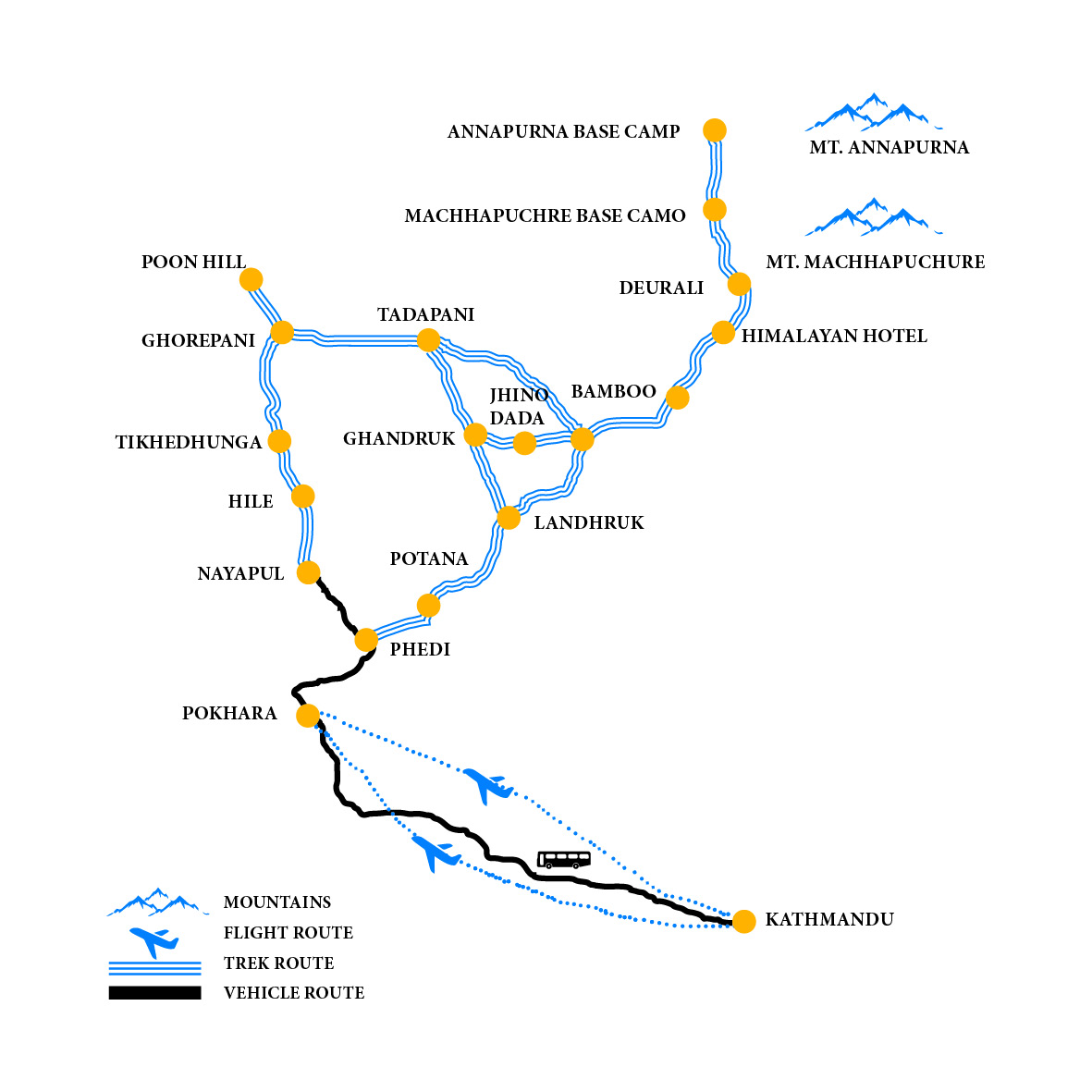
Elevation Chart & Map