


The Langtang Ganja La Pass trek is scenic and adventurous in the Langtang region of Nepal. It is considered one of the more challenging treks due to its high-altitude pass, but it offers breathtaking views and a chance to experience the culture and natural beauty of the Himalayas.

Highlights of the Langtang Ganja La Pass Trek:
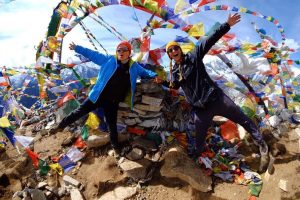
- Ganja La Pass:
The trek crosses the Ganja La Pass (5,130 meters or 16,829 feet), which is one of the highest points of the trek. The pass offers panoramic views of the Langtang Range, Jugal Himal, and other nearby peaks. - Langtang Valley:
This trek begins in the beautiful Langtang Valley, known for its lush forests, waterfalls, and wildlife, including the red panda. The valley is culturally rich, with Tibetan-influenced villages like Kyanjin Gompa and Langtang Village. - Remote Villages and Tibetan Culture:
Along the way, you will pass through traditional Tamang and Tibetan villages, where you can experience the unique culture, architecture, and hospitality of the local people. - Wildlife:
The Langtang National Park, which encompasses the region, is home to diverse flora and fauna, including snow leopards, Himalayan tahr, and various bird species. - Stunning Views:
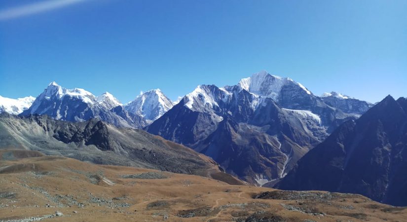
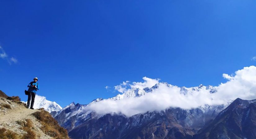
Besides the Ganja La Pass, trekkers will be treated to spectacular views of snow-capped mountains, glaciers, and alpine meadows. The trek also passes through high-altitude landscapes that are less crowded compared to other trekking regions in Nepal. - Challenging Terrain:
The trek is considered strenuous and requires good fitness due to the altitude and challenging terrain, including steep ascents, rocky paths, and occasional snow. It’s important to acclimatize properly to avoid altitude sickness.
Best Time to Trek:
The best seasons for the Langtang Ganja La Pass trek are autumn (September to November) and spring (March to May), as the weather is generally stable, and the skies are clear for optimal views.
Preparation:
- Fitness: It is important to be in good physical shape.
- Permits: You’ll need the Langtang National Park permit and the TIMS card (Trekkers' Information Management System).
- Guides/Porters: Due to the difficulty of the trek and potential navigation challenges, it is recommended to go with a guide. Some trekkers also hire porters to carry luggage.
This trek is perfect for experienced trekkers looking for a challenging and less-traveled route with rewarding views of the Himalayas.
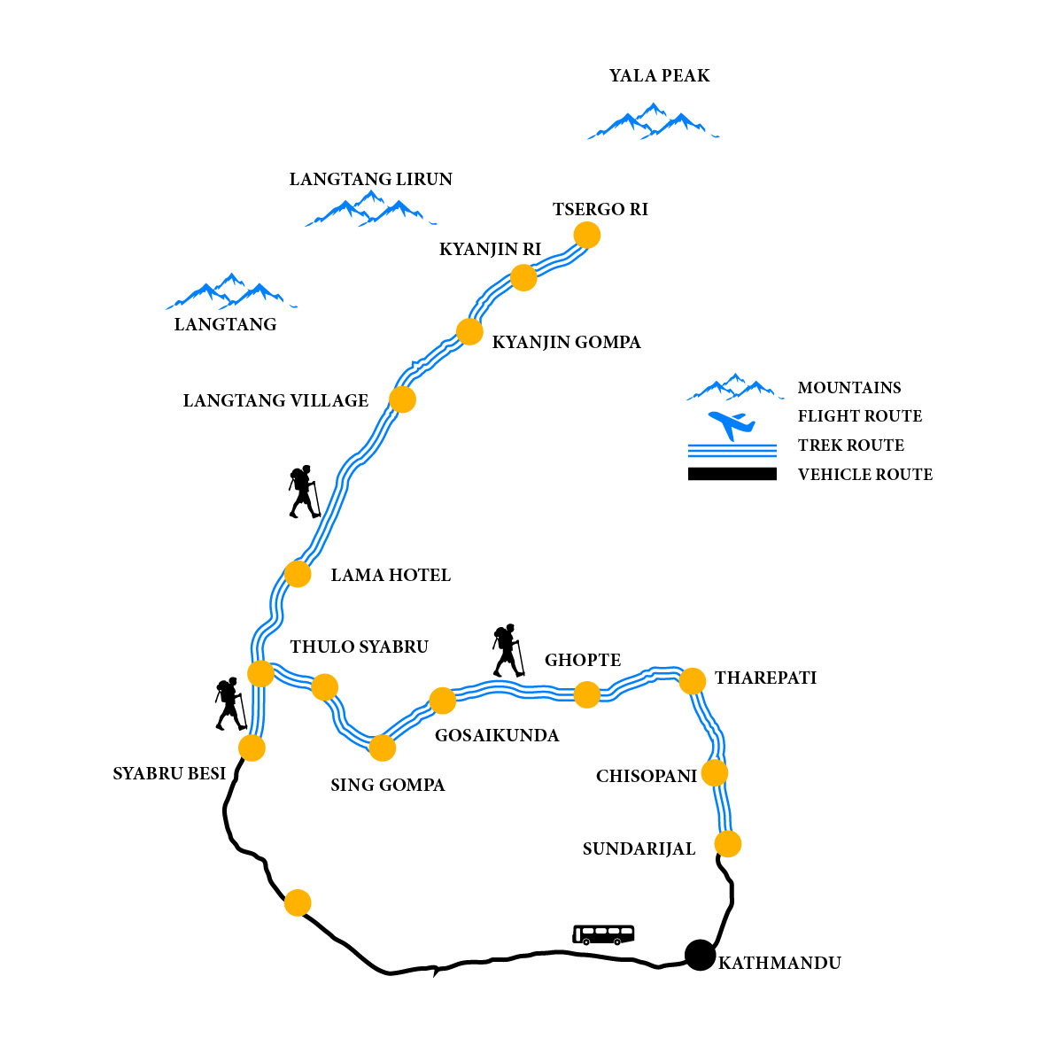
Trip Outline
Day 01: Drive to Syabru Besi by local Jeep (Alt.1460m/4,789ft), 5-6 hours.
Day 02: Trek to Lama Hotel (Alt.2410m/7,904ft), 5 hours walk.
Day 03: Trek to Langtang village (Alt.3330m/10,922ft), 4 hours walk.
Day 04: Trek to kyanjyang Gompa (Alt.3730m/12,234ft), 4 hours walk.
Day 05: Rest day/Exploration day at Kyanjyang Gompa.
Day 06: Trek to Nyengang (Alt.4430m/14,530ft), 4 hours walk.
Day 07: Trek over the Ganja-la pass (5130m) and trek to keldang (Alt.4270m/14,005ft), 7 hours walk.
Day 08: Trek to Dukpu (Alt.4040m/13,251ft), 4 hours walk.
Day 09: Trek to Tarke Ghyang (Alt.2740m/8,987ft), 5 hours walk.
Day 10: Trek to Shyarmanthang (Alt.2590m/8,495ft), 4 hours.
Day 11: Trek to Melamchi Pul Bazaar (Alt.870m/3,825ft), 4 hours walk. And drive back to Kathmandu, 5 hours.
Detail itinerary
Day 01: Drive to Syabru Besi by local Jeep or Bus
7 Hrs B/L/d Tea House
After morning breakfast we drive out along the north-western hills of Kathmandu. Enjoy the Himlayan views and mountainous lifestyle through the terraced fields and rustic villages. Take Lunch at the Trishuli Bazar before continuing further to Dhunche. From Dhunche, we descent down to Syabrubesi.
Day 02: Trek to Lama Hotel
6 Hrs B/L/D Tea House
This is our first day of trekking today. Follow the Langtang Khola River. Pass through the dense forests. Cross several suspension bridges. We also pass by a tea houses. The trail goes up and down but it's not that challenging.
Day 03: Trek to Langtang village
5 Hrs B/L/D Tea House
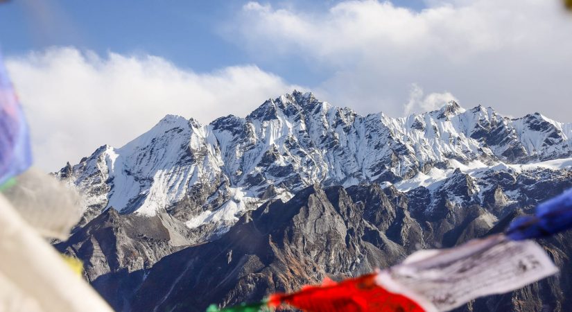
Today after breakfast, we start our trekking day towards the village of Mundu. Our trail continues along dense forests. After making a steady climb up through the valley, we leave the tree line behind us. Enjoy the marvelous views of Langtang Lirung. On the way to Mundu, you will also pass the Langtang Village, which was severely affected the the earthquake last year. Langtang Valley alone lost 400 lives, flooded away by an earthquake-triggered avalanche, destroying an entire village and infrastructures. We also see the ruins of Langtang Village, where life is slowing building back and a few tea-houses are reopened
Day 04: Trek to kyanjyang Gompa
5 Hrs B/L/D tea House
After breakfast, we will start our journey to Kyangjin Gompa, a principal monastery of the region. You will pass by water mills, prayer wheels, chortens, with sacred mounds of rocks with inscriptions carved on them. Also pass the largest mani wall in Nepal, made from stone with prayers written on them. The prayers written on the mani wall is supposed to be blown away by the wind. After the short trek, you will spend the rest of the afternoon exploring the buddhist shrine and surrounding areas with the amazing views of the mountains.
Day 05: Rest day/Exploration day at Kyanjyang Gompa
3 Hrs B/L/D tea House
After taking morning tea and breakfast,we get out of the village and pass on through yak pastures and start for visiting to Tserko Ri (5000m/16,404ft) for mountain sunrise views. Since, we are really getting into the high altitudes, you might start feeling the thin air. In the afternoon return to Kanjin Gompa- surrounded by the Himalayas all around. You can take a walk around Kanjin Gompa enjoying the views, glaciers, icefalls, birds and yaks.
Day 06: Trek to Nyengang
5 Hrs B/L/D Tea House
Taking today's breakfast, we embark on our today's journey to Ganja La Phedi. Cross the Langtang River. Ascend through rhododendron forests. Since, we're already in high altitude, the time for getting to our destination also depends upon the season of the trek. Since, during the winter snow, it might take longer time to cross the snow strewn path
Day 07: Trek over the Ganja-la pass
8 Hrs B/L/D Tea House
Today we cross the Ganja La pass. It'd be a strenuous day since Ganja La is one of the difficult passes. Ganja la pass is covered with snow almost throughout the year. Make the long ascent through the boulders, pass the small lakes, and summit the Ganja La which situated on a rocky moraine. Enjoy the spectacular views from the pass. Climbing up and down the pass can sometimes be tricky due to snowfall and ice. From the pass, we descend down to Keldang.
Day 08: Trek to Dukpu
5 Hrs B/L/D Tea House
Trek from Keldang to Yak Kharka. From Keldang, we descend further down following a prominent ridge line. In our 5-6 hrs trek today, we continue losing our altitude through forests, ridges, and grasslands.
Day 09: Trek to Tarke Ghyang
6 Hrs B/L/D Tea House
Today, we lose altitude considereably, about 1500 meters. The trail would be similar, except that as you descend lower, you will notice more vegetation.
Day 10: Trek to Shyarmanthang
5 Hrs B/L/D Tea House
We cross small forest with the view of beautiful village of Helembu region. The trail makes a sweep around the wide valley end between Parachin and the pretty Sharpa village of Gangyul. The people of this village practice Drukpa Kagyu Buddhism, the same as the national religion of Bhutan
On our final day of the trek, we walk down to Malemchi Pul Bazaar with many Sherpa village. From the Bazaar, catch a bus to Katmandu. To celebrate the successful completion of our journey, we will have a farewell dinner in the evening.
What's included?
- Trekker’s Information Management System(TIMS) card
- All governmental procedure fees, permits and local taxes.
- All meals and accommodation throughout the trek.
- An experienced English speaking trekking guide possessing valid license issued by the government of Nepal.
- Highly experienced trekking staffs.
- Travel and rescue arrangements.
What's not included?
- Visa fees/ international airfare to and from Kathmandu
- Travel / medical insurance and emergency evacuation cost.
- Hot and cold shower, battery recharge during Everest base camp trek.
- Personal expenses phone calls, bar bills, extra porters, beverages etc.
- Personal Everest base camp trekking equipments/gears.
- Tips for guides, porters and drivers.
- All others expenses not mentioned in “Trip Cost Includes” section
Elevation Chart & Map